Sleet and Showers: Winter’s Grip Holds Firm on the Queen City
Morning: A Foggy and Damp Start
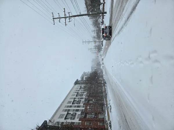
As Charlotte wakes up this Wednesday, February 4, 2026, the region continues to grapple with the aftermath of a historic weekend snowstorm that dumped between 6 and 12 inches of snow across the metro area. The morning hours are expected to be characterized by lingering mist and dense fog, which may significantly reduce visibility for early commuters. While temperatures have risen slightly above the freezing mark, the air remains damp with a 40% chance of rain showers beginning in the early morning. These showers may initially manifest as a light wintry mix before transitioning to straight rain as the sun rises.
Afternoon: Slushy Conditions and Rising Temps
By midday, the high temperature is expected to reach approximately 48°F. While this is a welcome reprieve from the sub-freezing temperatures of the past few days, it brings its own set of challenges. The National Weather Service (NWS) has noted that the rapid melting of existing snowpack, combined with afternoon rain, will likely lead to poor drainage and localized flooding in low-lying areas. Pedestrians and drivers should expect heavy slush and deep puddles on secondary roads. Cloud cover will remain heavy throughout the day, providing little opportunity for surfaces to dry out before the next wave of weather arrives.
Evening: The Return of the Wintry Mix
The forecast taking hold this evening is of particular concern for residents. Starting between 7:00 PM and 10:00 PM, a fresh cold front will push into the Piedmont. As temperatures drop back toward a low of 33°F, current rain is expected to quickly transition into a mix of freezing rain, sleet, and light snow. While snow accumulations this evening are expected to be light—less than half an inch—the potential for freezing rain accretion of up to 0.10 inches poses a significant risk for black ice formation on local bridges and overpasses.
Key Alerts and Community Impact
Due to the combination of existing road hazards and the incoming wintry transition, the following notices are in effect:
- School Closures: Charlotte-Mecklenburg Schools (CMS) have announced a remote learning day for Wednesday, February 4. Instruction will be asynchronous as the district continues to monitor road safety.
- Travel Warning: Local authorities are discouraging non-essential travel after sunset. The transition to freezing rain this evening is expected to create hazardous, slick conditions through Thursday morning.
- Utility Safety: With light ice accretion possible on trees already weakened by the weekend storm, residents should be prepared for potential isolated power outages.
Stay tuned to local updates as this system moves through the region. Remember to check on neighbors and ensure pets are brought indoors as the freezing line returns to the Queen City tonight.